|
|
Post by kaima on Sept 23, 2021 21:47:31 GMT -7
|
|
|
|
Post by pieter on Sept 24, 2021 6:20:27 GMT -7
Kaima,
Rivers were and are an important transport system in Europe with our riverboats that often sail through Europe from country to country. Ten thousands of miles these river boats go, often through many countries. I grew up near the Western Scheldt (Dutch: Westerschelde) in the province of Zeeland in the southwestern Netherlands. The Western Scheldt is the estuary of the Scheldt river. This river once had several estuaries, but the others are now disconnected from the Scheldt, leaving the Westerschelde as its only direct route to the sea. The Western Scheldt is an important shipping route to the Port of Antwerp, Belgium. Of of course in my later life I encountered a lot of large, middle big, small and very small rivers in various European countries. The Netherlands, Belgium, Luxemburg, France, Germany, Poland, the Czech Republic, Hungary, England, Denmark, Italy, Switzerland and Austria. I saw the lack of rivers in South-Africa and at the West Coast of the USA and what drought can mean to places like Las Vegas and Cape Town. Water shortage. These European rivers were life lines, important trade routes, dividing lines between territories, had military importance and often gave names to regions, muncipalities or institutions or organisations. In various Dutch cities you had the North/South divide in cities and towns. Often the North being the rich part and the South being the poor part, often the Southern sections were later build and settled for some reason. The river gave certain protection next to city walls. In the past centuries the water of the river was also drinking water, water for washing clothers and water for commercial practices like Water mills. The river was the most important transport route, next to horse and carriage on dusty and bumpy roads. And these roads were often dangerous due to rober knights, criminal bands in the forest and woods and rival estates (of counts, dukes, earls, Barons or Prince Bishops -like the Prince Bishops of Utrecht or Liège-), cities and regions.This is the place I grew up in. I love that sight of these tall boats and the pilot boats on the Wester Scheldt.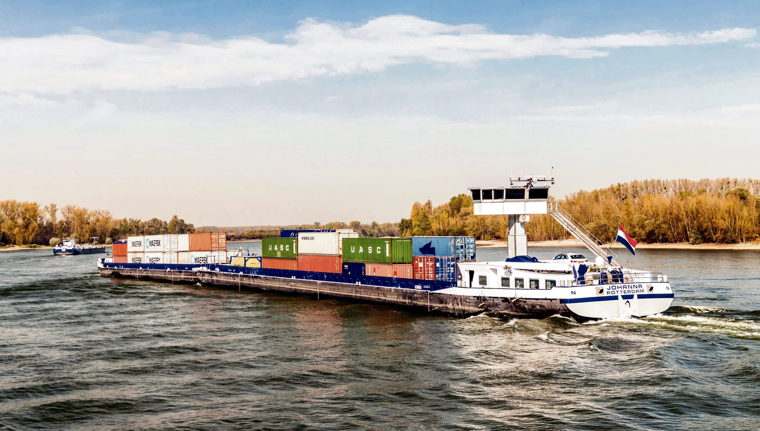 A typical Dutch Binnenvaartschip (River Boat) A typical Dutch Binnenvaartschip (River Boat)  Another typical Dutch Binnenvaartschip (River Boat) on the Rhine river somewhere in the Netherlands Another typical Dutch Binnenvaartschip (River Boat) on the Rhine river somewhere in the Netherlands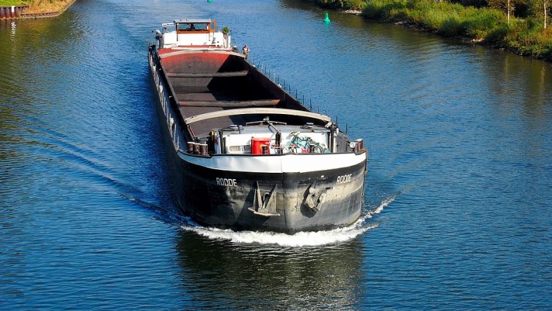 An empty ship which transports sand for construction, coals or other materials An empty ship which transports sand for construction, coals or other materials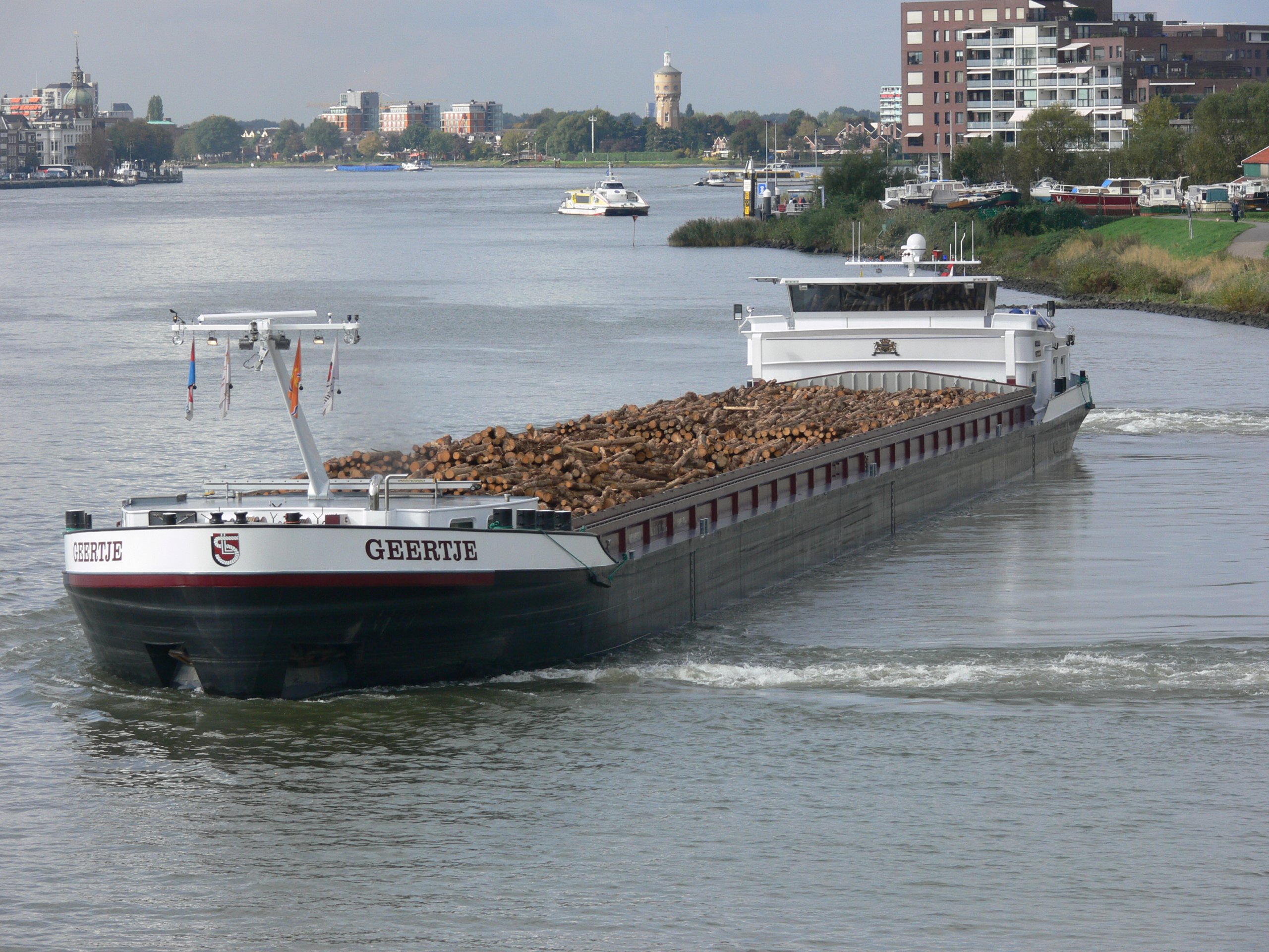 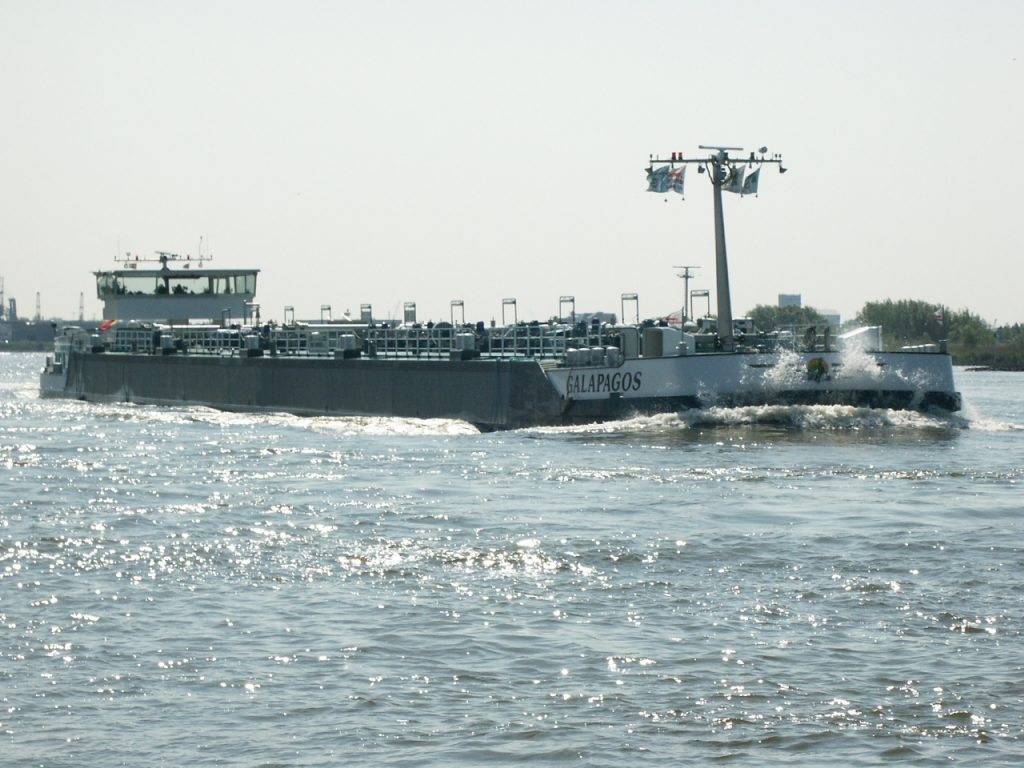 A river boat carrying gas A river boat carrying gas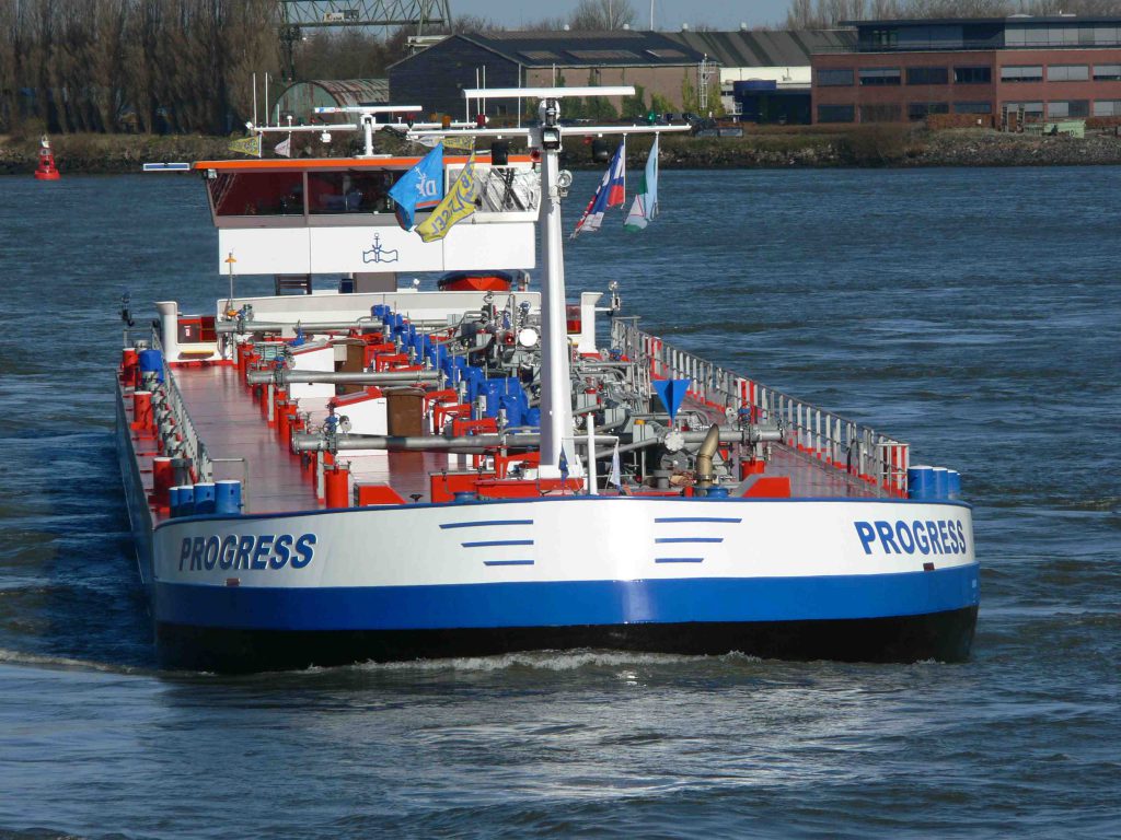 A river boat carrying petrol, we call it a tank ship (Tank Schip in Dutch) A river boat carrying petrol, we call it a tank ship (Tank Schip in Dutch)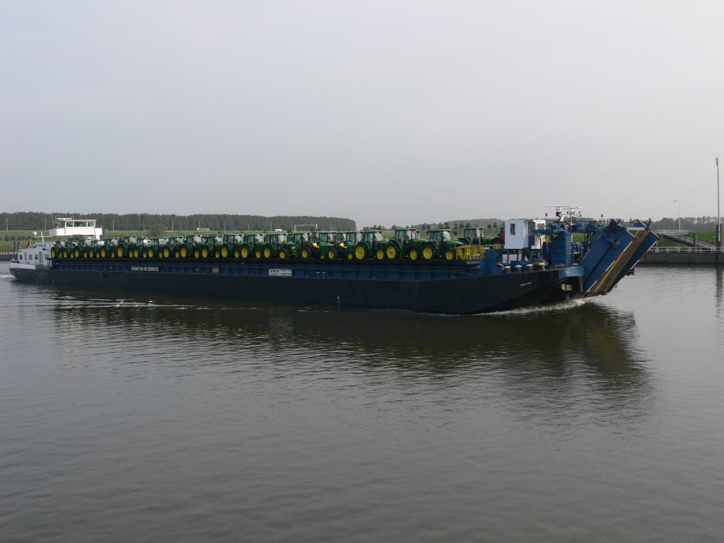 A roll-on-roll-off ship, or simply a ro-ro ship, can take all kinds of rolling cargo on board with a tail lift, such as new cars and delivery vans, trucks, but also tractors or army vehicle A roll-on-roll-off ship, or simply a ro-ro ship, can take all kinds of rolling cargo on board with a tail lift, such as new cars and delivery vans, trucks, but also tractors or army vehicles. Today of course thousands of Trucks drive over the international E-road network, a numbering system for roads in Europe developed by the United Nations Economic Commission for Europe (UNECE) and over National highways an regional highways and roads. The densly populated Dutch highways are densly crowded with tens of thousands of trucks, cars, vans, busses and motor bikes. I drive a lot between Gelderland and Zeeland every week. 216.4 kilometers about 134.5 miles. Three Provinces, Gelderland, Noord-Brabant and Zeeland. It amazes me every time how bussy these roads are and how much transport goes through the Netherlands, from South to North and vice versa, from the West to the East and vice versa and diagonal from the North-West to the South-East and from the North-East and East to the South-West. When I go to Zeeland I always drive on a highway that leads to Antwerp (Belgium) and I see a lot of Belgian and German cars in the South next to Dutch ones, and also French and British cars.
If I stop along the highway for a moment of rest or to tank my Ford Fiesta, I stand in between dozens of huge trucks from the Netherlands, Poland, Lithuania, Humgary, Bulgaria, Romania, Germany and Ukraine. Most struck drivers on Dutch Trucks are Polish Truck drivers. So many Dutch Daf trucks, Scania Trucks, Volvo Trucks or Mercedes-Benz Trucks with Dutch number plates have Polish or other Central- or Eastern-European drivers, because the central- and Eastern-European drivers are cheaper than the Dutch drivers due to the Dutch labour system and power of the Dutch Unions (FNV/CNV).
The highways are the new European rivers. Next to the highways and roads, the rivers and chanals, we have our sea ports (harbours) and the Airports as transport hubs. A lot of goods come into the Netherlands via Schiphol Airport, Rotterdam Airport and Eindhoven Airport. Next to Passengers Schiphol Airport is a large transport airport as well and a lot of Commercial Transport Planes land there.
Still the system of transport over the large rivers is functionating well. In the Netherlands the Rhine River (Rijn in Dutch), the Meuse River (Maas in Dutch) and the
The Large rivers (Grote rivieren) have throughout history been a dividing line across the Netherlands. At many points in time have the rivers formed a boundary between states or empires. Notable examples include the northern border of the Roman Empire in the Roman province of Germania Inferior, and the border between the Dutch Republic and Spanish and later Austrian Netherlands at various points in their contentious history. The latter of these historical examples also played a large role in the religious divide the rivers straddle.
The term Grote rivieren (Large rivers) refers to the division of the Netherlands by the Nederrijn, Lek, Waal, Merwede and Meuse rivers, which dominate an area roughly 150 km in length from west to east and 25 km wide from north to south. The rivers form part of the Rhine-Meuse-Scheldt delta which discharges into the North Sea. The rivers are the primary distributaries of the Rhine and Meuse rivers, flowing from the Swiss Alps and the Langres plateau respectively..png)   
|
|
|
|
Post by pieter on Sept 24, 2021 6:25:32 GMT -7
|
|
|
|
Post by pieter on Sept 24, 2021 6:33:12 GMT -7
|
|
|
|
Post by pieter on Sept 24, 2021 6:39:13 GMT -7
|
|
|
|
Post by pieter on Sept 24, 2021 6:42:26 GMT -7
|
|
|
|
Post by pieter on Sept 24, 2021 6:44:44 GMT -7
The guy sounds like a Dutchman (his accent)
|
|
|
|
Post by pieter on Sept 24, 2021 6:45:31 GMT -7
|
|
|
|
Post by pieter on Sept 24, 2021 6:47:47 GMT -7
|
|
|
|
Post by pieter on Sept 24, 2021 6:48:36 GMT -7
|
|
|
|
Post by pieter on Sept 24, 2021 6:49:41 GMT -7
|
|
|
|
Post by pieter on Sept 24, 2021 6:56:42 GMT -7
|
|
|
|
Post by pieter on Sept 24, 2021 6:58:09 GMT -7
|
|
|
|
Post by pieter on Sept 24, 2021 7:02:52 GMT -7
Please watch this wonderful video on Youtube
|
|
|
|
Post by pieter on Sept 24, 2021 7:04:02 GMT -7
The Po River in Italy
The Po (/poʊ/ POH, Italian: [ˈpɔ]; Latin: Padus or Ēridanus; Ancient Greek: Πάδος, romanized: Pádos, or Ἠριδανός, Ēridanós; Ancient Ligurian: Bodincus or Bodencus) is the longest river in Italy. It is a river that flows eastward across northern Italy starting from the Cottian Alps. The Po flows either 652 km (405 mi) or 682 km (424 mi) – considering the length of the Maira, a right bank tributary. The headwaters of the Po are a spring seeping from a stony hillside at Pian del Re, a flat place at the head of the Val Po under the northwest face of Monviso. The Po then extends along the 45th parallel north before ending at a delta projecting into the Adriatic Sea near Venice.
It is characterized by its large discharge (several rivers over 1,000 km have a discharge inferior or equal to the Po). As a result of its characteristics, the river is subject to heavy flooding. Consequently, over half its length is controlled with argini, levees.[1]
The river flows through many important Italian cities, including Turin, Piacenza, Cremona and Ferrara. It is connected to Milan through a net of channels called navigli, which Leonardo da Vinci helped design. Near the end of its course, it creates a wide delta (with hundreds of small channels and five main ones, called Po di Maestra, Po della Pila, Po delle Tolle, Po di Gnocca and Po di Goro) at the southern part of which is Comacchio, an area famous for eels. The Po valley was the territory of Roman Cisalpine Gaul, divided into Cispadane Gaul (south of the Po) and Transpadane Gaul (north of the Po).
|
|